Crossing Districts
West Delhi
Purpose and Objectives
Purpose and Objectives
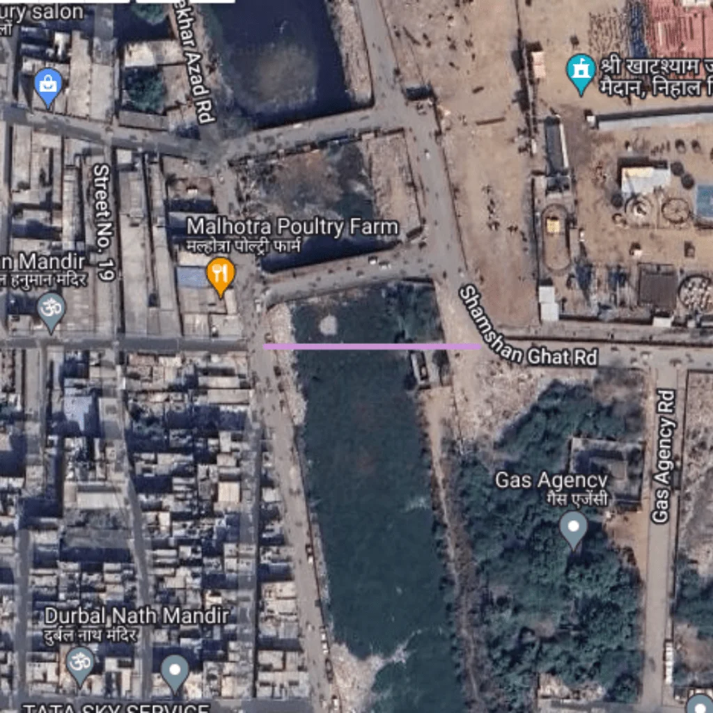
The primary goal of this route is to enhance connectivity in the densely populated areas of Chandan Vihar and Jawalapuri Extension. By reducing travel times, this route helps in managing traffic flow more efficiently, which is particularly important during peak hours. It also aims to provide a safer and more reliable commuting experience for pedestrians and vehicle traffic alike.
Route Map
DC Chandan Vihar to Jawalapuri Extension
1
Starting Point: Chandan Vihar
Latitude and longitude: 28.67427, 77.07675
2
Ending Point: Jawalapuri Extension
Latitude and longitude: 28.67427, 77.07748
Benefits
Traffic Benefits
Despite the modest distance, the reduction in actual travel time from 1 minute to just 0.4 minutes leads to a 60% time saving. This significant percentage indicates a substantial improvement in efficiency for daily commuters and local traffic. The reduction helps in minimizing the time vehicles spend on the road, which can contribute to decreased traffic congestion and lower emissions.
Conclusion
The DC Chandan Vihar to Jawalapuri Extension route exemplifies how targeted urban planning and infrastructure development can effectively address transportation issues in metropolitan areas. By significantly reducing travel times over a short distance, this route enhances the overall commuting experience, promotes environmental sustainability through reduced idle times, and aids in the fluid movement of traffic in West Delhi. Such projects are crucial for improving urban living standards by making cities more accessible and navigable.
Purposed Roads of India
Purposed Roads of North East India


