Crossing Districts
Purpose and Objectives
Purpose and Objectives
The primary goal of this project is to alleviate traffic congestion between Nihal Vihar and Paschim Vihar, two densely populated areas in West Delhi. The initiative aims to provide a swift and efficient commuting option, enhancing connectivity and reducing travel-related stress for residents.
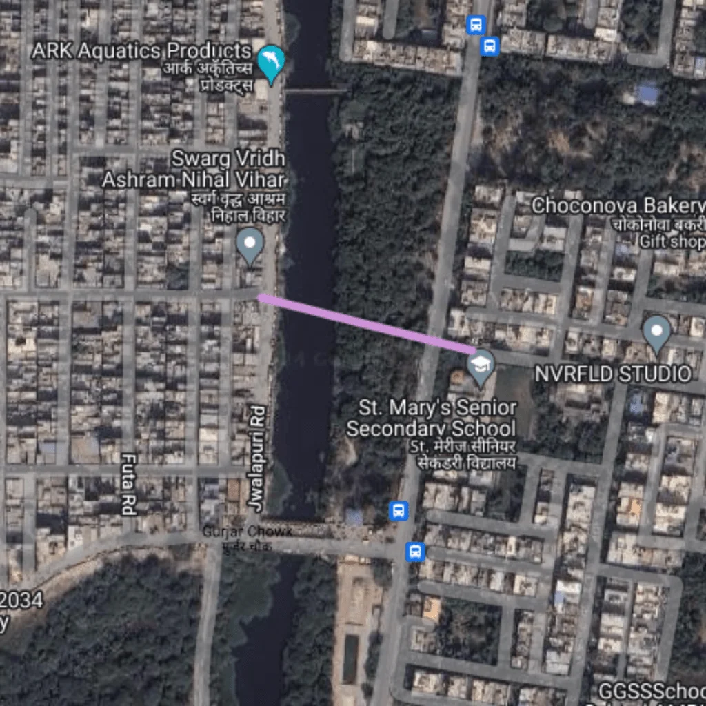
Route Map
DC Nihal Vihar to Paschim Vihar
1
Starting Point: Nihal Vihar
Latitude and longitude: 28.66664, 77.07789
2
Ending Point: Paschim Vihar
Latitude and longitude: 28.66632, 77.07938
Benefits
Traffic Benefits
This route achieves a remarkable reduction in travel time, cutting down from 7 minutes to just 0.9 minutes, reflecting an 87% decrease in travel duration. Such efficiency is instrumental in decreasing overall traffic volume on adjacent roads and reducing emissions from idling vehicles. The shortened distance and time also imply less fuel consumption and lower operational costs for vehicles, contributing to environmental and economic benefits.
Conclusion
The DC Nihal Vihar to Paschim Vihar route exemplifies successful traffic management and urban planning in West Delhi. By drastically reducing travel times and offering an expedited connection between two major residential areas, it not only improves daily commuting experiences but also serves as a model for similar projects aimed at enhancing urban mobility. This route underscores the importance of targeted infrastructure improvements in addressing the challenges of urban transportation and supporting sustainable city development.
Purposed Roads of India
Purposed Roads of North East India


