Crossing Districts
South Delhi
Purpose and Objectives
Purpose and Objectives of Ashram to Faridabad Elevated Road:
The Ashram to Faridabad Elevated Road project is aimed at addressing key transportation challenges and enhancing connectivity between Ashram in Delhi and Faridabad in Haryana. The objectives of the project align with improving traffic flow, reducing travel time, and providing a seamless commuting experience for residents and commuters in the region.
Key Points:
- Reduction of Red Lights and Traffic Congestion:
- One of the primary goals of the Ashram to Faridabad Elevated Road project is to minimize the number of red lights and alleviate traffic congestion along the route. By providing an elevated road, the project aims to streamline traffic flow and reduce delays, particularly at congested intersections and junctions.
- Surrounding Areas Benefited:
- The road project is expected to benefit surrounding areas, including residential neighborhoods, commercial hubs, and industrial zones along the Ashram-Faridabad corridor. Reduced traffic congestion and improved connectivity will enhance accessibility and facilitate smoother movement of goods and people.
- Time Savings:
- Commuters using the Ashram to Faridabad Elevated Road can anticipate significant time savings in their daily travels. By offering a more direct and efficient route, the project aims to minimize travel times and optimize the commuting experience for residents and businesses in the region.
- Enhanced Connectivity:
- Improving connectivity between Ashram in Delhi and Faridabad in Haryana is a key objective of the road project. By providing an elevated road infrastructure, the project enhances accessibility and connectivity, making it easier for people to travel between the two locations and access key destinations along the route.
Quantifiable Impact:
- Reduction in Travel Time: The Ashram to Faridabad Elevated Road project is designed to significantly reduce travel times for commuters. By minimizing traffic congestion and providing a faster route, the project aims to optimize travel efficiency and enhance overall mobility in the region.
Benefits for Surrounding Areas:
- Improved Traffic Conditions: The road project benefits surrounding areas by improving traffic conditions and reducing congestion along the Ashram-Faridabad corridor. Enhanced traffic flow and reduced travel times contribute to a more efficient transportation network, benefiting both commuters and businesses.
Public Satisfaction and Traffic Stress Management:
- Enhanced Public Satisfaction: The completion of the Ashram to Faridabad Elevated Road project is expected to enhance public satisfaction by offering a more convenient and time-efficient commuting experience. Reduced congestion and improved connectivity contribute to a positive perception among road users.
- Effective Traffic Stress Management: The road project plays a crucial role in managing traffic stress by reducing congestion and streamlining traffic flow. By providing an elevated road infrastructure, the project helps alleviate stress associated with traffic delays and congested road conditions.
In conclusion, the Ashram to Faridabad Elevated Road project aims to improve traffic conditions, enhance connectivity, and provide a more efficient transportation network for residents, businesses, and commuters along the route. By focusing on reducing travel times, minimizing congestion, and optimizing road infrastructure, the project contributes to the region's development and public satisfaction.
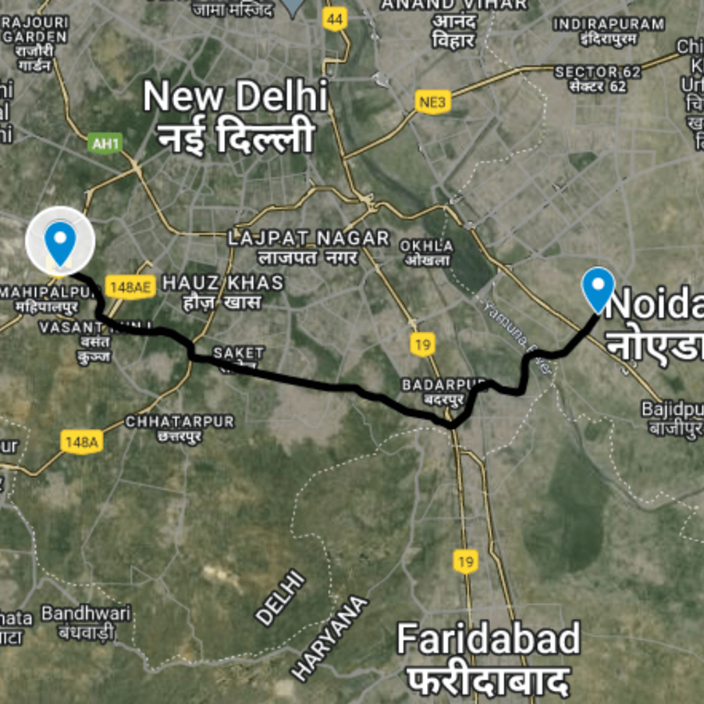
Route Map
Ashram to Faridabad Elevated Road
|
Proposed Interchanges
Total Interchange Point : 6
1.Start from Interchange On Mathura Road Sarita Vihar, Latitude and longitude : 28.56915, 77.26071
2.Interchange On Mezzanine, Ishwar Nagar , Latitude and longitude : 28.56082, 77.26695
3. Interchange On Modi Mill Flyover , Latitude and longitude : 28.55706, 77.26977
4. Interchange On Chennai - Delhi Highway Jasola, Metro Station , Latitude and longitude : 28.53536, 77.28521
5.Interchange On Crossing South Delhi Border 1, Latitude and longitude :28.52529, 77.29191
6. Interchange On Tajpur Pahari, Ali , Latitude and longitude :28.51533, 77.29684
Purposed Roads of India
Purposed Roads of North East India