Crossing Districts
North Delhi, North West Delhi, Central Delhi, West Delhi, South West Delhi
Purpose and Objectives
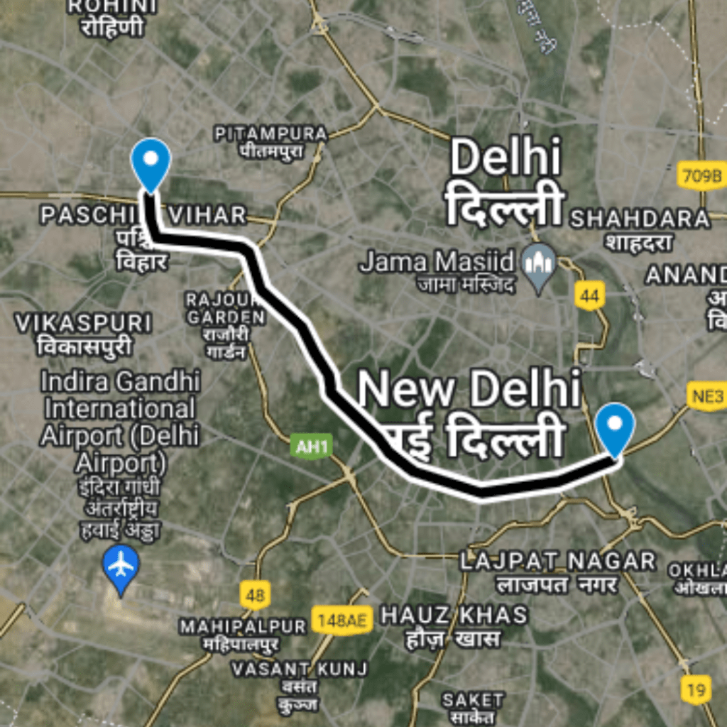
- Signature Bridge Connectivity: The expressway commences at the Signature Bridge interchange, creating a vital connection point in the city's infrastructure network.
- Enhanced Access to Residential Areas: Interchanges at locations such as Kamla Nagar, Inderlok, and Sudershan Park provide improved access to densely populated residential areas, enhancing daily commute experiences for residents.
- Strategic Links: Interchanges with major roads like GT Karnal Road, Rohtak Road, and Najafgarh Road establish strategic links, fostering efficient movement of traffic and goods.
- Uttam Nagar Connectivity: The expressway contributes to the connectivity of Uttam Nagar, a significant locality in West Delhi, further supporting urban development initiatives.
- Najafgarh Road and Dwarka Connectivity: The interchange points on Najafgarh Road and UER 2 Dwarka are instrumental in connecting areas like Dwarka and Najafgarh, contributing to the overall connectivity landscape of Delhi.
The Sahibi River Expressway aims to fulfill multiple objectives:
- Alleviate Traffic Congestion: By providing alternative routes and connecting key areas, the expressway aims to reduce congestion on existing roads.
- Enhance Regional Connectivity: The project's design emphasizes enhancing connectivity across districts, promoting smoother transportation within the city.
- Support Urban Development: Improved connectivity to residential and commercial hubs contributes to the overall urban development of the city.
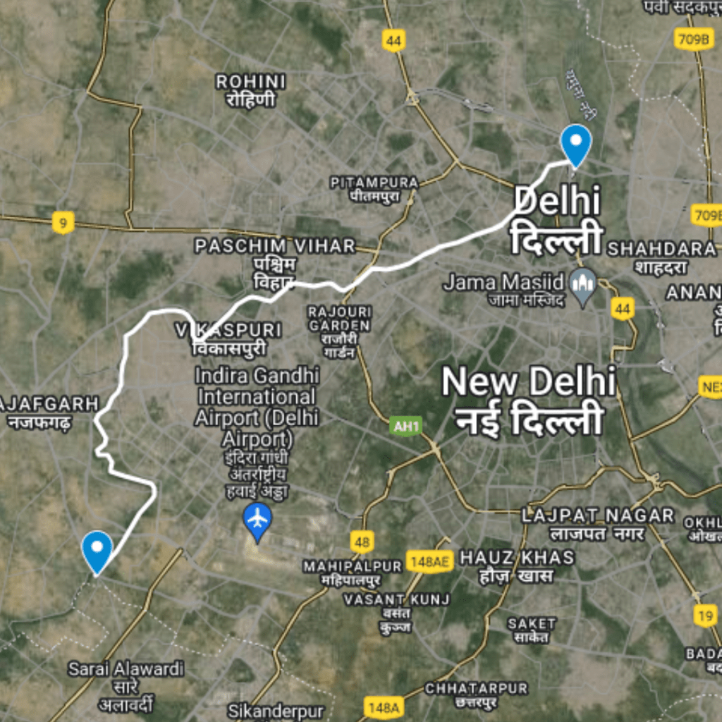
Route Map
Sahibi River Expressway
|
Proposed Interchanges
Total Interchange Point : 22
1.Start from Interchange On Signature Bridge , Latitude and longitude :28.70662, 77.22998
2. Interchange On T point Outer Ring Road - Nehru Vihar Road , Latitude and longitude : 28.70964, 77.2271
3. Interchange On Mall Road, GTB Nagar , Latitude and longitude : 28.69731, 77.20928
4. Interchange On T point Naha Road - Vijay Nagar Marg, Reids Line , Latitude and longitude : 28.69276, 77.2058
5. Interchange On GT Karnal Road - Kamla Nagar , Latitude and longitude : 28.68444, 77.19646
6. Interchange On Shakti Nagar, Swami Narayan Marg , Latitude and longitude : 28.68083, 77.18523
7.Interchange On Inderlok, Metro Station Inderlok, Latitude and longitude : 28.67592, 77.16816
8. Interchange On Rohtak Road - Service Road , Latitude and longitude : 28.67106, 77.15837
9. Interchange Patel Road, Shiv Das Puri Marg , Latitude and longitude : 28.66696, 77.13825
10. Interchange On Mahatma Gandhi Marg - Sudershan Park , Latitude and longitude : 28.66056, 77.12947
11. Interchange On Raghubir Nagar , Raghubir Road , Latitude and longitude : 28.66009, 77.10873
12 . Interchange On Raghubir Nagar Road - Vishnu Garden , Latitude and longitude : 28.66008, 77.09934
13. Interchange On Vikaspuri Flyover - Nala Marg , Latitude and longitude : 28.65415, 77.08886
14. Interchange On Vikaspuri, Latitude and longitude :28.64991, 77.0735
15. Interchange On T Point Nala Road - Uttam Nagar , Latitude and longitude :28.63864, 77.06005
16. Interchange On T Point Ranhola Bridge , Latitude and longitude :28.65003, 77.04161
17. Interchange On Kheri Baba Bridge Road , Latitude and longitude : 28.63531, 77.02513
18. Interchange On Najafgarh Road - Shivaji Marg , Latitude and longitude :28.62037, 77.02309
19. Interchange On Kakrola Road , Latitude and longitude :28.60618, 77.01115
20. Interchange On Qutub Vihar, Latitude and longitude : 28.5774, 77.03819
21. Interchange On UER 2 Dwarka, Latitude and longitude :28.56002, 77.02516
22. Interchange On Najafghar Road - Kapashera Road , Latitude and longitude :28.54383, 77.01145